The time had finally come to embark on our long anticipated hike. Laura and I first hiked together on the Overland Track in 2006, and had floated the idea of the Larapinta as early as 2011, but it took us until 2022 to get serious about the planning. We now live in different states, and were planning to arrive in different ways (I was driving up from Launnie, Laura flying in from Sydney). We arrived by bus and plane from different quarters, converging on Alice within 1.5 hours of each other.
Day One – Section Twelve – Mt Sonder saddle and Redbank Gorge
On the day our hike commenced, we were picked up from our Alice Springs accommodation and driven west along Larapinta Drive to the Western Terminus, which lies at the base of Mt Sonder in the West MacDonnell Ranges.
We made camp then headed straight for Sonder. The return hike to the summit is 15.8km. We were in two minds about how hard to push ourselves on this first day. Both being a little out of practice and knowing we had more than two weeks ahead of us on trail, we decided against walking all the way to the summit, opting instead to hike to the saddle and then do the side trail to Redbank Gorge.
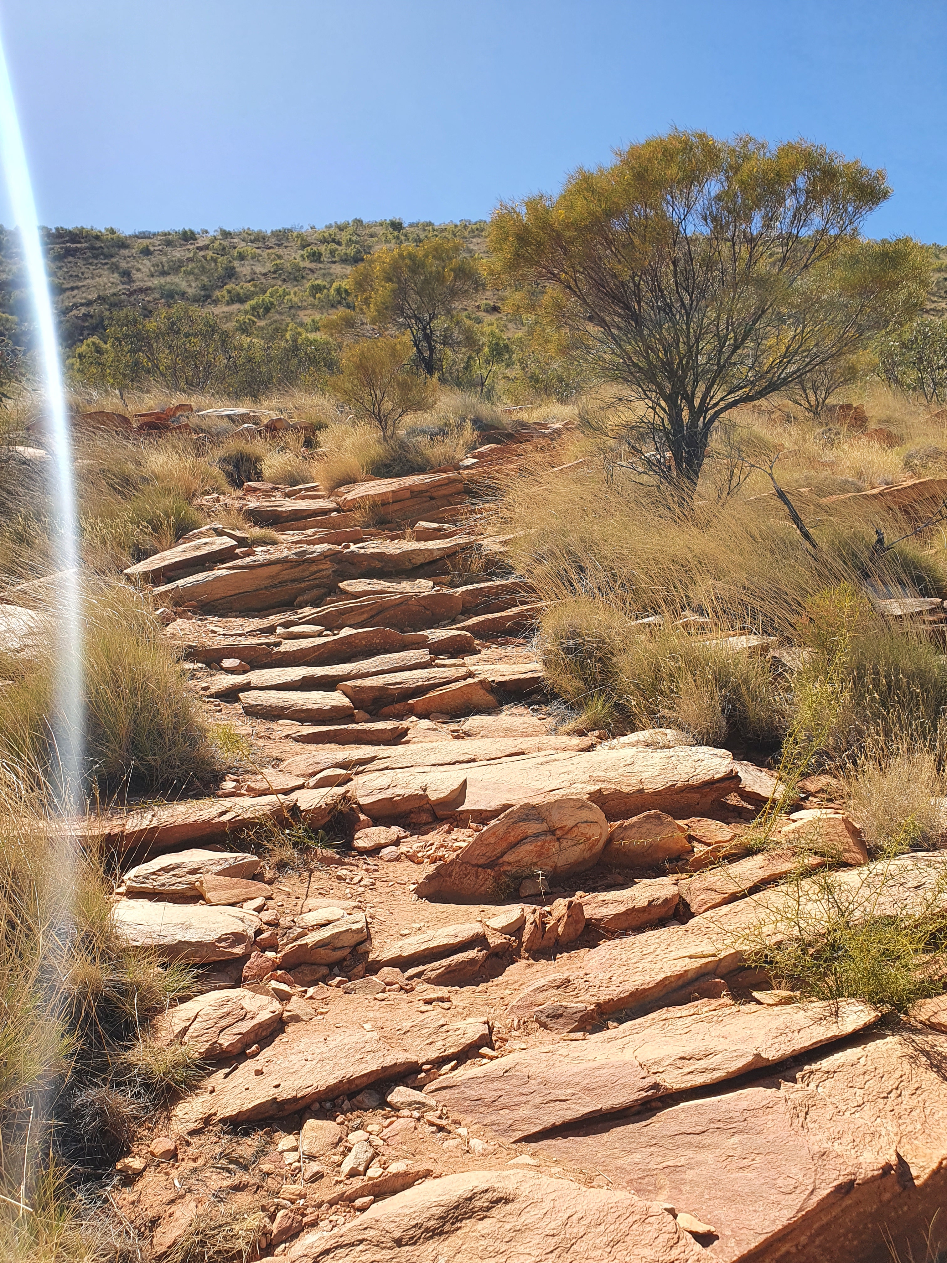


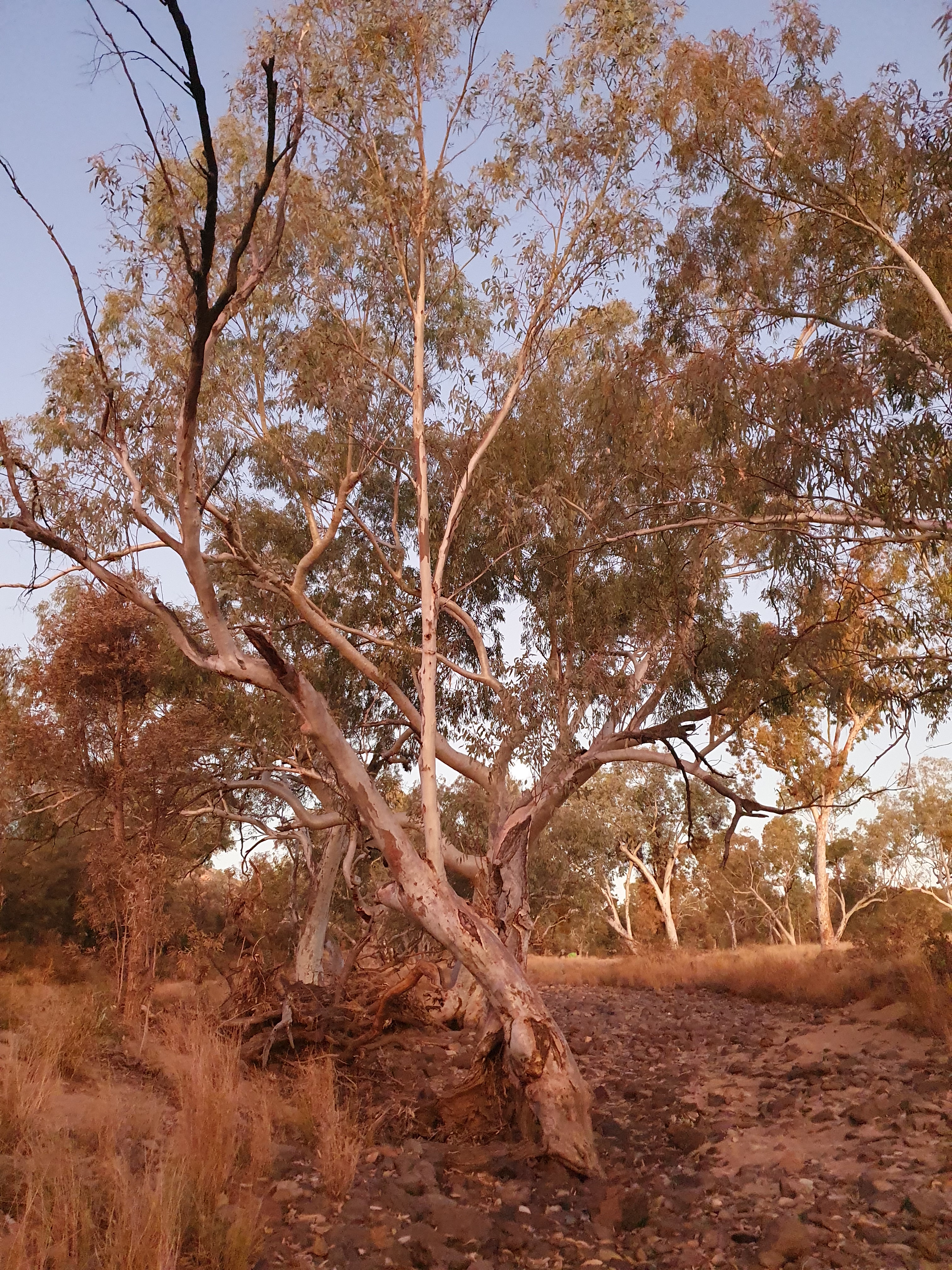
We started to get a sense of the abundance of plant life in the desert, and the amazing colour palette that awaited us on trail.


Mallee Flowers


One of the taxi drivers who shuttled us around Alice told us about the river systems in the NT, explaining that even when the riverbeds contain no water, the rivers continue to flow underground, enabling the trees to survive the dry years. Alice Springs is a surprisingly spread out town for its population and given the geographical terrain, with mountain ranges on most sides and a river that flows right through town when the wet season brings enough rain. So taxis are sometimes a necessity, and a great source of local knowledge.

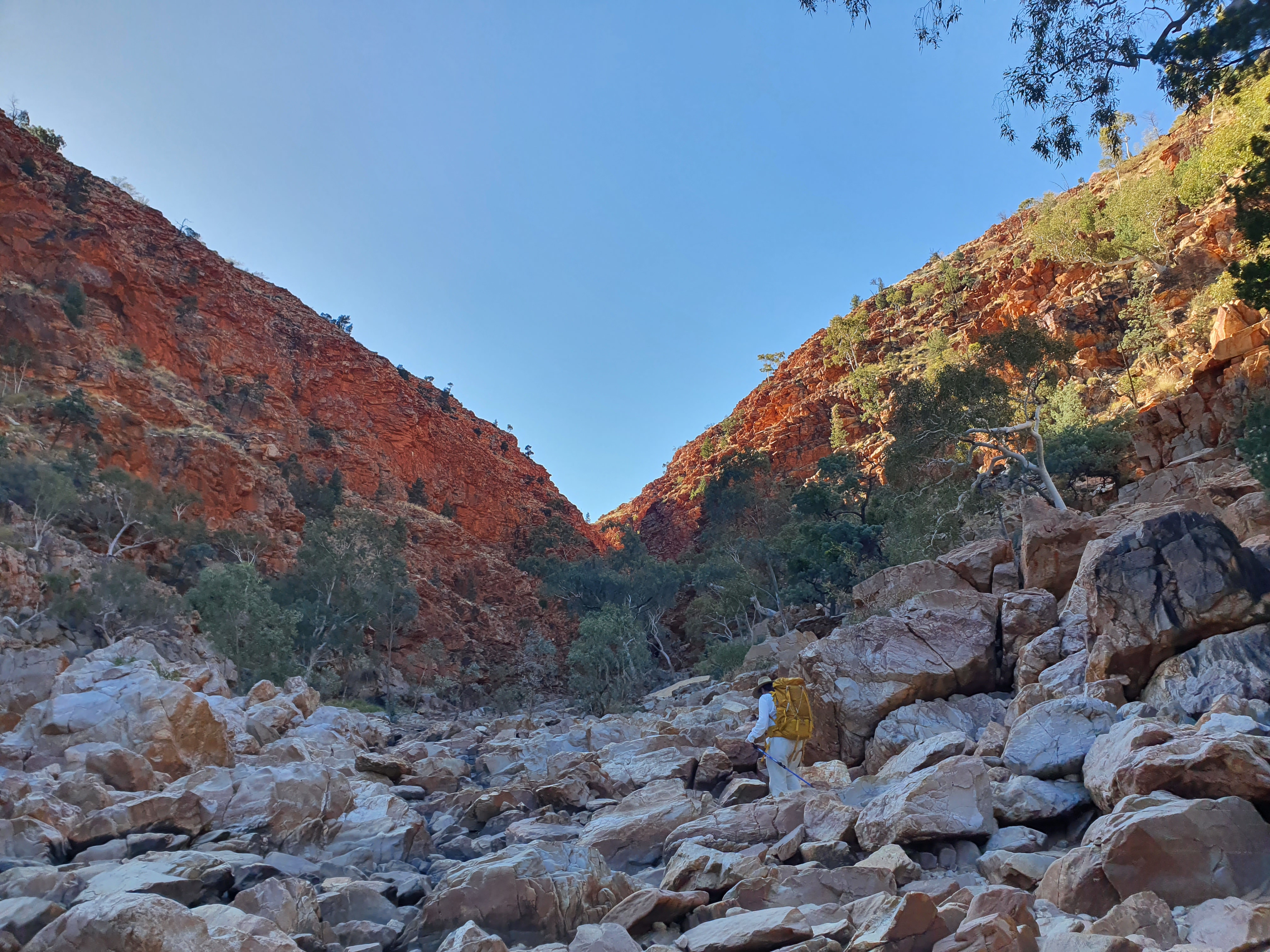


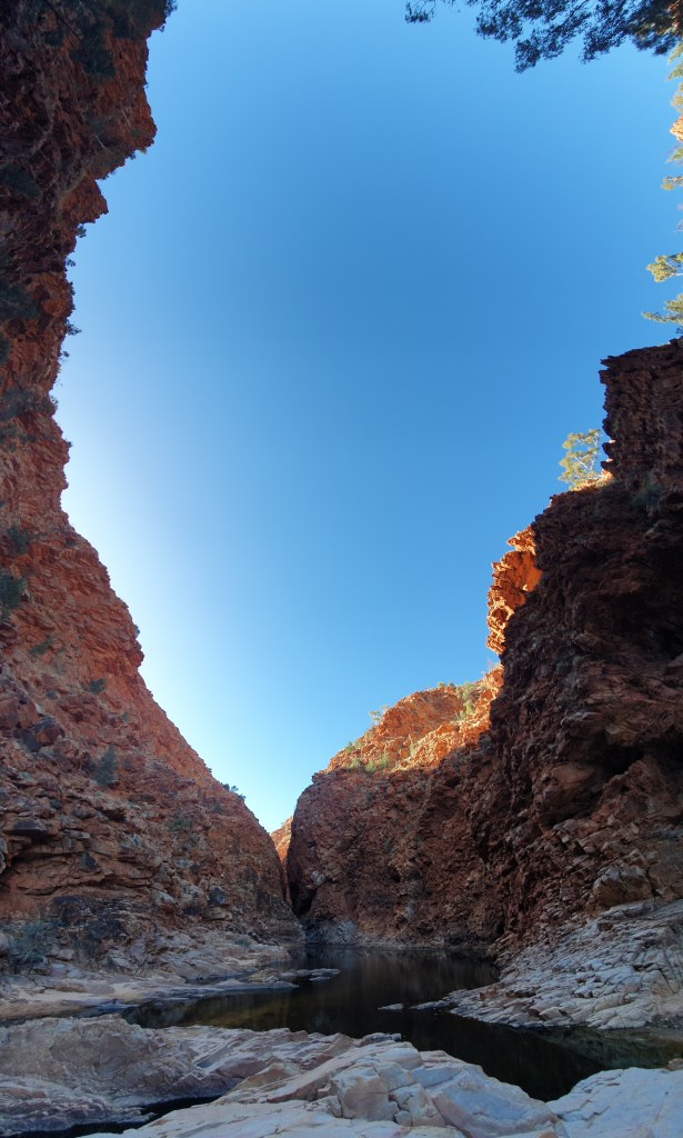
A very lovely way to spend our first day. I left Laura to soak her feet in a waterhole, and walked as far as I could down the gorge, startling a heron into flight as I clambered over a last rocky outcrop before the gorge narrowed too much for further progress. I could have swum the last stretch, but it was late in the day so the temperature had dropped considerably. There was also the small detail of all the dead fish floating in the water. Apparently this is a natural recurrence, something that happens each year once the water temperature drops below a certain level. There are several factors, including bacteria taking up residence on the gills of the fish, depriving them of oxygen; and colder surface water temperatures causing the surface water to sink to the bottom, displacing the deeper water in the waterholes, with the same ultimate effect of oxygen deprivation. Not particularly comforting, but part of the cycle of life.
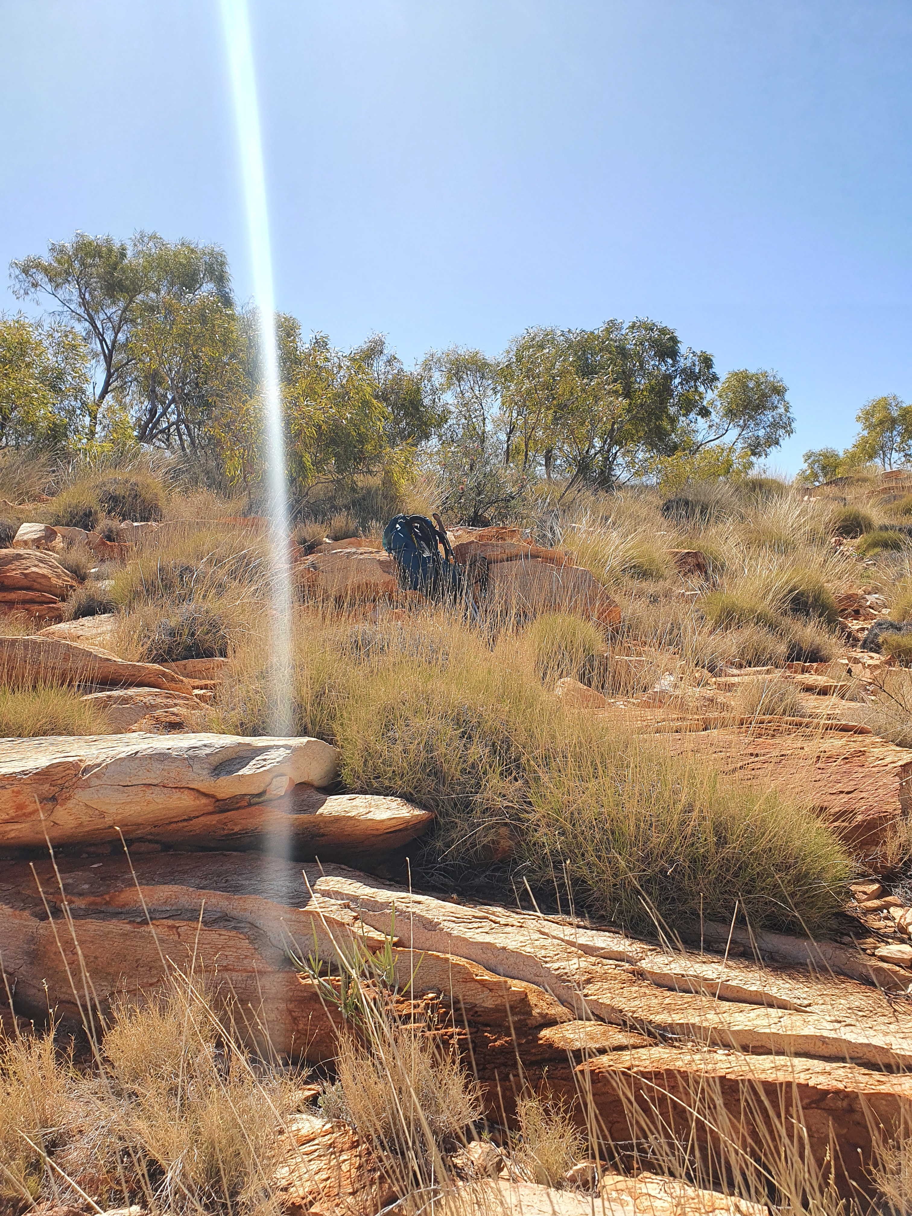
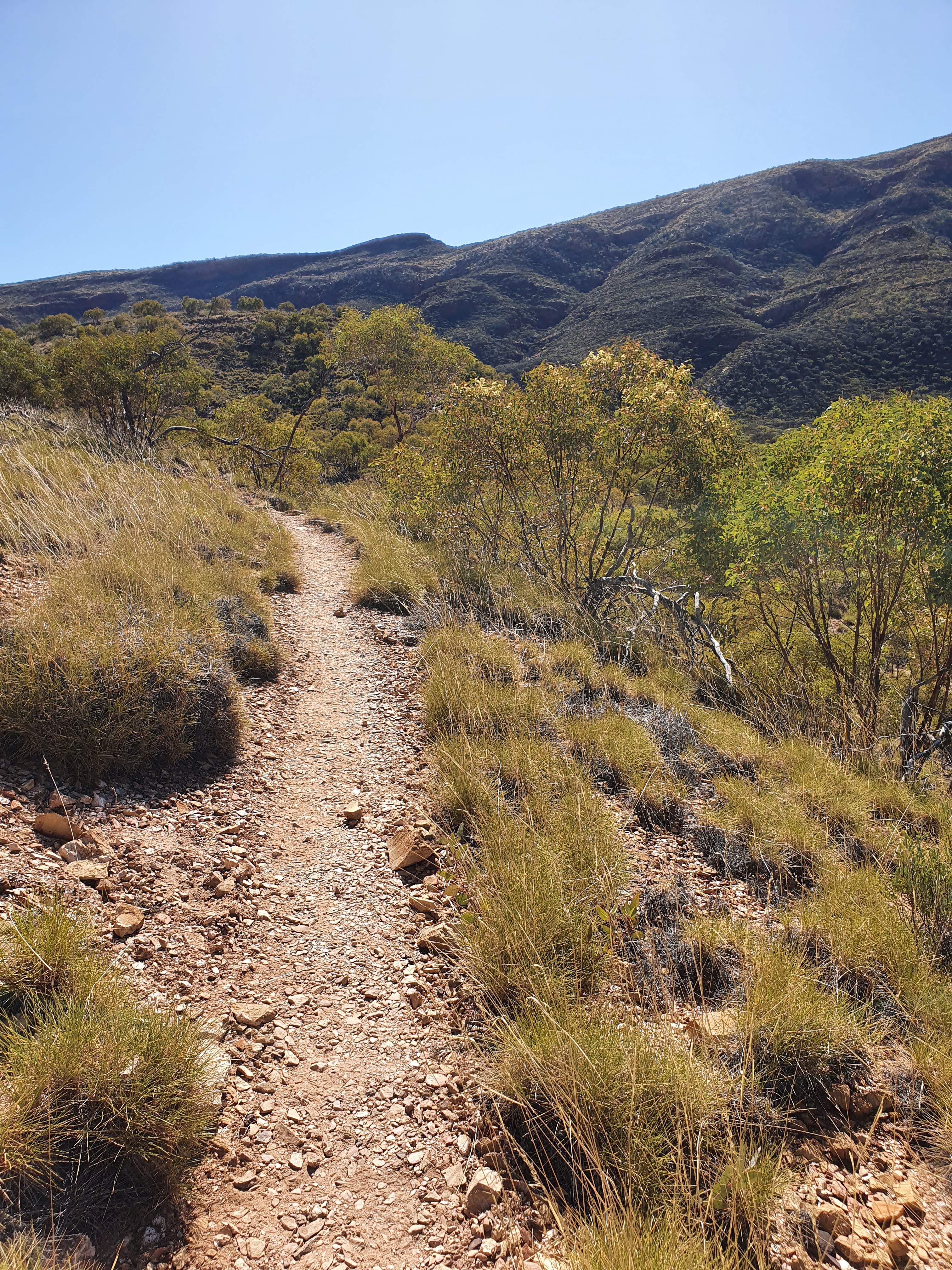
If you look closely at the tree in the centre distance, you can see one of the blue arrows that are used as trail markers along the length of the Larapinta and which would be our constant companions for the next 18 days.

I lent Laura my Appalachian Trail tent (the Silver Big Agnes Fly Creek Ultralight) and I carried my latest tent, the little red Mont Moondance 1. The Moondance is my fourth tent since I started solo hiking. My first was called an Oberon and I picked it up from Allgoods back in 2002. I still have that tent somewhere. It kept me warm and dry over several months of living in a tent down here in Tassie back in 2002. But that is a story for another time. My second was the MSR Hubba. I had that tent from 2005 until 2016. I backpacked around Europe, hiked the Camino in Spain, the Overland Track in Tas, the Six Foot Track from Katoomba in the Blue Mountains to Jenolan Caves, and many other adventures over the years. I started the Appalachian Trail with the Hubba in 2016, but discovered on day two that it was no longer leak-proof, so purchased the Big Agnes from the Mountain Crossings outfitters at Neels Gap on the fourth day of the hike (along with seemingly every other AT Thru Hiker that year – there were nights on trail when I would get up for a loo break and then have trouble locating my Big Agnes amongst a sea of identical Big Agneses – good grief). The Big Agnes Flycreek is a great tent – it truly is ultra light – but it is not free standing, and I loved that feature of the Hubba, so it was the main thing I was looking for in a tent that could handle Tassie’s varied terrain (as well as any other long distance trails I chose to embark upon, such as the Larapinta). I gifted my MSR Hubba to my friend’s son upon purchase of the Mont Moondance, with the disclaimer that it was now a fair-weather tent. It was a great little tent, and I am so pleased that it is getting a second life providing someone else with scope for outdoor adventures.

Despite a distinct lack of appetite on both our parts (this often happens to me when I commence long hikes), we cooked up the butter chicken style paneer and rice (sans chicken) and ate as much as our stomachs could handle so as to lighten our load for the onward journey. It was delicious.

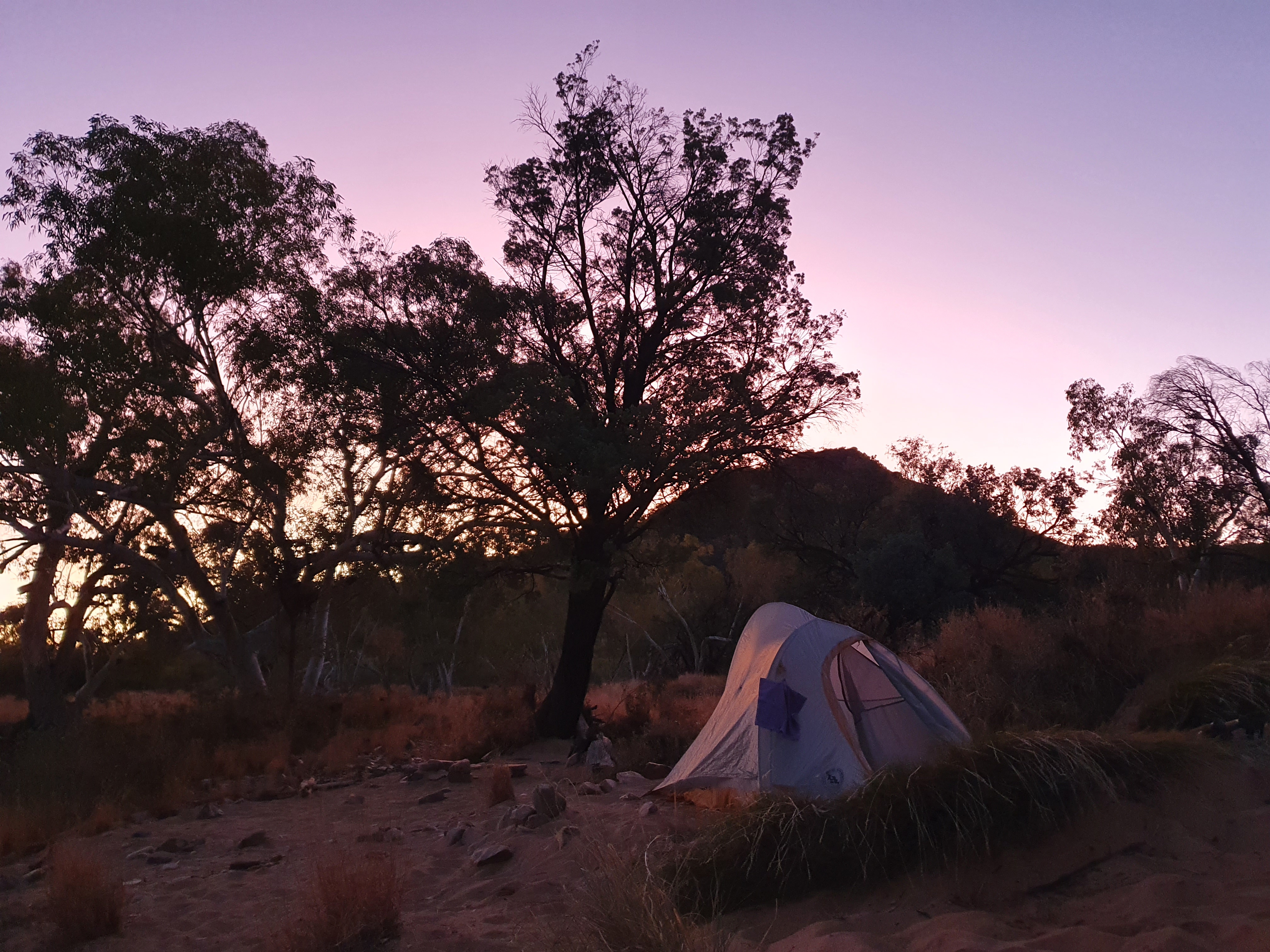
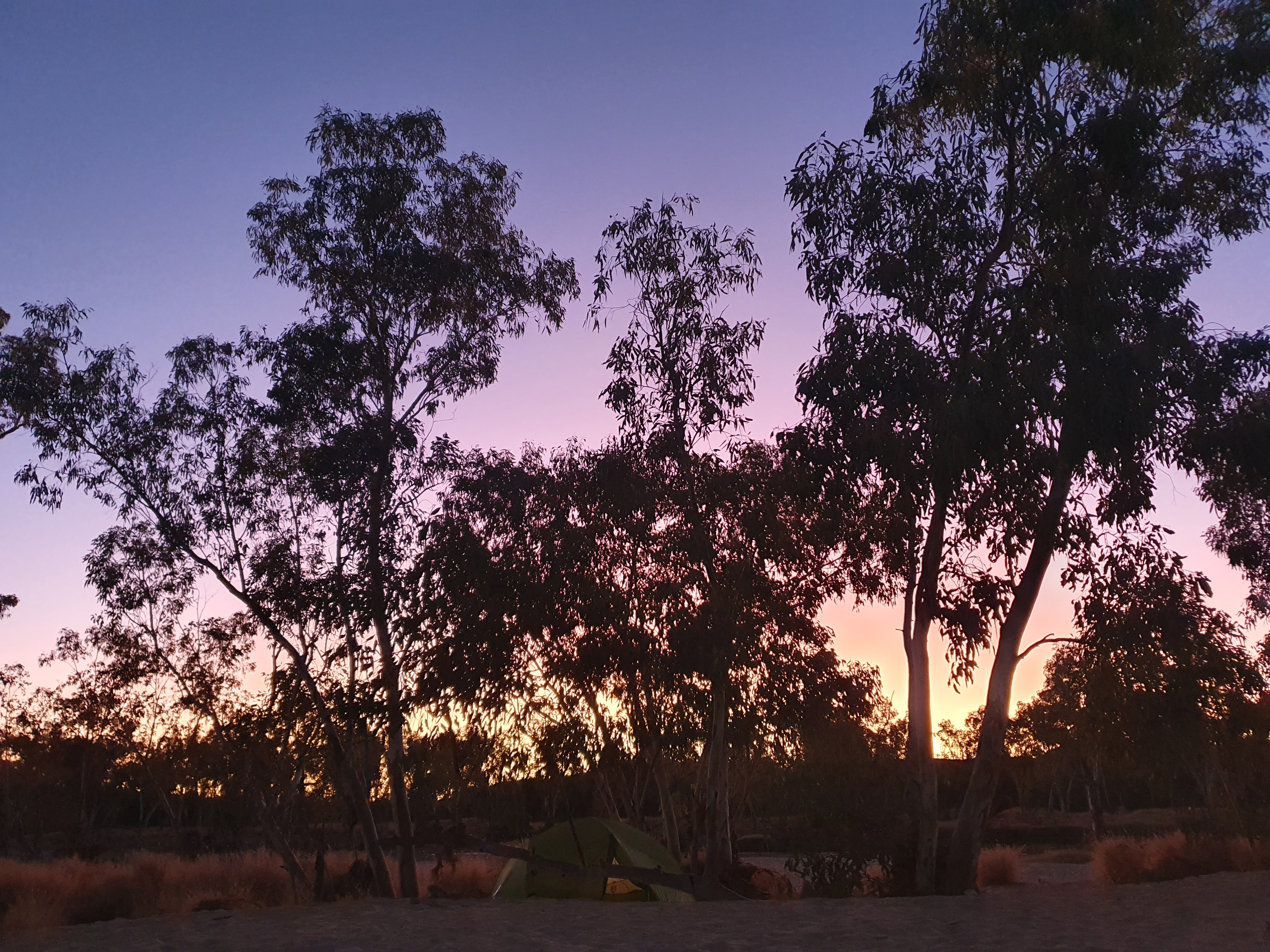
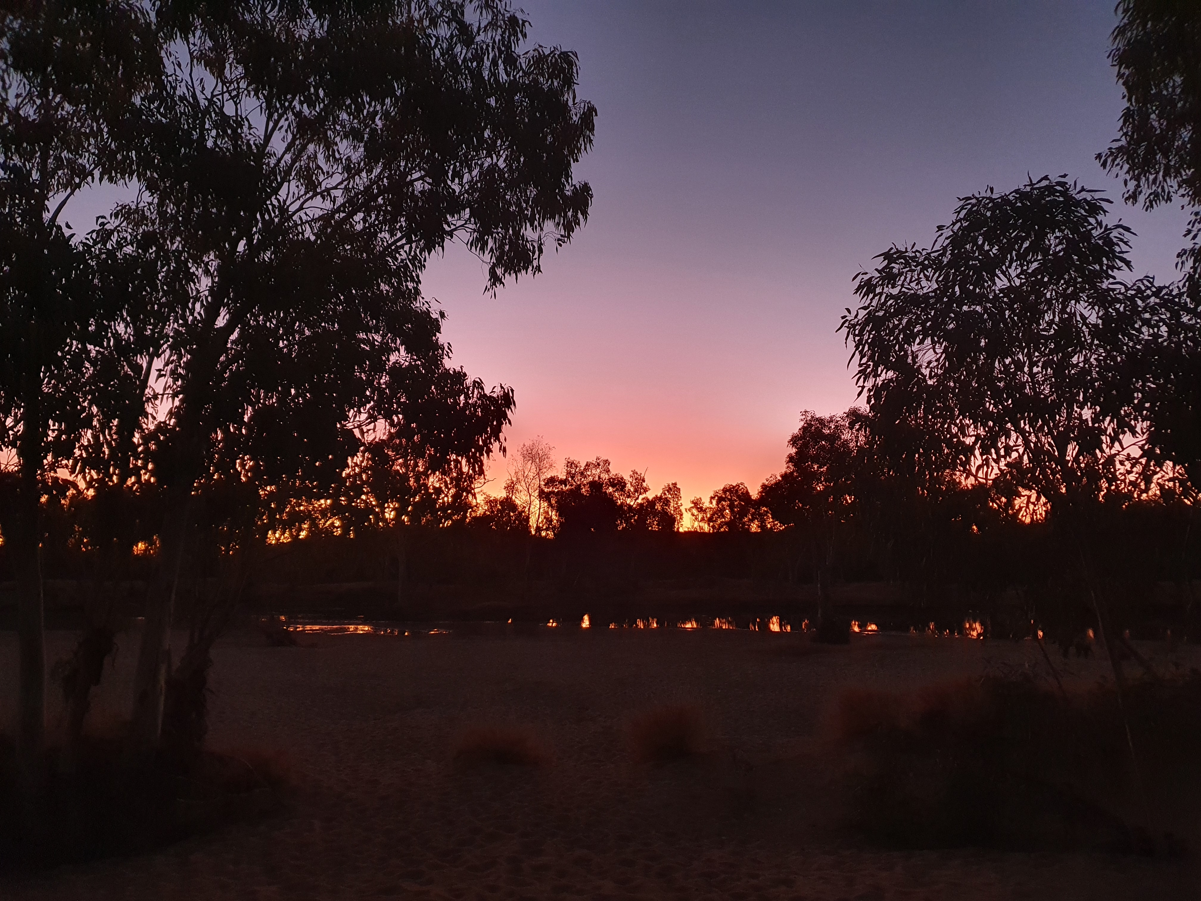
There was a full moon on our first night on trail. Once the moon rose high in the sky, it was lighter than this twilight – we could have hiked through the night without need of headlamps (if we’d been that way inclined). Many hiking east to west choose to do exactly that in order to greet the sunrise from the summit of Mt Sonder. It would be a spectacular sight to be sure.
Day Two – Section Eleven – Redbank Gorge to Rocky Bar Gap

We spent a lazy first morning exploring the shelter, enjoying our first trail breakfast, reading about the trail and packing up at leisure. We only had 11.1km to hike to our next campsite, so there was no immediate rush. We met Peter and Sonja (from just out of Canberra) for the first time at Redbank Gorge. They were hiking a similar schedule to us, so we continued to encounter them in camp each night as far as Ormiston Gorge, where they continued on as we took a rest day to organise our resupply. They were keen wildflower enthusiasts and were often spotted photographing specimens along the way, then ticking them off their lists in the evening. Sonja, like me, had embarked upon a career as an academic but decided to move away from her field for many of the same reasons I did. She told me of her subsequent ongoing work as an editor and suggested it as a possible career avenue that I might benefit from exploring.


The guidebook and maps were both clear, however, in their claims that this was one of the easiest days on trail, so we didn’t lull ourselves into a false sense of the relative ease of the journey ahead.


I fell backwards onto some spinifex here, giving myself splinters in the finger and thumb and jabbing myself in the back through three layers of clothing – Laura kindly extracted that spine when we arrived at camp. Looks soft? Decidedly not. I learnt quickly about the brutality of the spinifex and maintained a respectful distance for the remainder of the hike.


We met a hiker going by the name of Mel here at Rocky Bar Gap. She was almost at the end of her hike and expressed sadness that she only had a couple of days to go. We noticed a bit of a pattern along these lines with hikers nearing completion that we encountered in the final stages of their walk. Several said they were envious of those just starting out, and wished they could turn around and start their trek again. When you are starting out you just can’t imagine wanting to carry your pack any further than you have to. I find the first week of adjusting to pack life such a challenge even after all the multi-day hikes I have done. I know that the pain does recede and that you come to love the feeling of having your home on your back and the feeling or resilience and resourcefulness that long distance hiking brings. But those first five-ten days sure are a steep learning curve! It was surreal but inspiring to hear people singing the praises of the trail.
Mel was a wealth of knowledge about the trail, giving us advice about the upcoming terrain, and warning us about the mice at some of the campsites to come. She told horror stories about underprepared hikers having holes chewed through their tents by hordes of hungry rodents, and gifted us some parachute cord so we could hang our food bags overnight. Thanks Mel, wherever you are. What a legend.

This was one of my favourite campsites on trail. We like to read to each other from our respective tents and this site provided enough space that we could do so without disturbing other hikers and without having to pack ourselves in like sardines.

Day Three – Section 11 Continued – Rocky Bar Gap to Finke River
A new day! We slept for about 12 hours following our first full day of hiking. We were each carrying over 20kgs when we set out, which was far more than we needed, and made the first few days particularly difficult. With the benefit of hindsight, however, it was probably the best thing we could have done in terms of preparing us for some of the challenges that lay ahead.
We didn’t rush our departure so were last to leave camp, but we definitely did better than our previous day’s effort, leaving camp by around 10:0am.


During our long chat with Mel the previous evening, we were also given the rundown on the km markers that we had noticed between Redbank Gorge and Rocky Bar Gap. In addition to the blue arrows that mark the trail at regular intervals along its entire length, each section of the trail has km markers that are designed to assist hikers with keeping track of how far they have come. Heading west to east, the numbers count down (which I found psychologically reassuring), and the count starts again with each section of the trail. Mel recommended using the km as a rough guide only, as she questioned their accuracy.
For me, it didn’t matter too much how accurate the markers were. They were a great indicator that you were making steady progress along the trail, and with the exception of the first day where we saw the same km marker repeated (I think it was either km marker 19 or 20), and the occasional instance where we would go 3-4kms without seeing one at all, they came with reliable regularity. They gave us goals to work towards, made for useful reconnection points on those days when we hiked at our own pace (i.e. I’ll meet you at marker 10!), and made for excellent measures of when it was time to start looking for a shady spot for lunch (i.e. shall we walk for another 3km and then start looking for a patch of shade?)
While you don’t want your entire hiking experience to be governed by the constant measure of logistical challenges, such as hills to climb, where and when to take breaks, and time and distance to travel, these things do become a major part of your day to day, and therefore do tend to occupy a fair amount of your mental landscape. And I love all that side of things. I love examining a topographical map, a gradient map, a guidebook with detailed km by km breakdown, reading about the experiences of those who have come before me, and logging my own experiences for others to read and benefit from when planning their own hikes. The planning and the experience go hand in hand, and the planning doesn’t stop once you take your first step on trail – it is something that follows you for its entire length and which you constantly return to, and have to adjust and modify as you adapt to the actuality of hiking thru (sic) terrain.


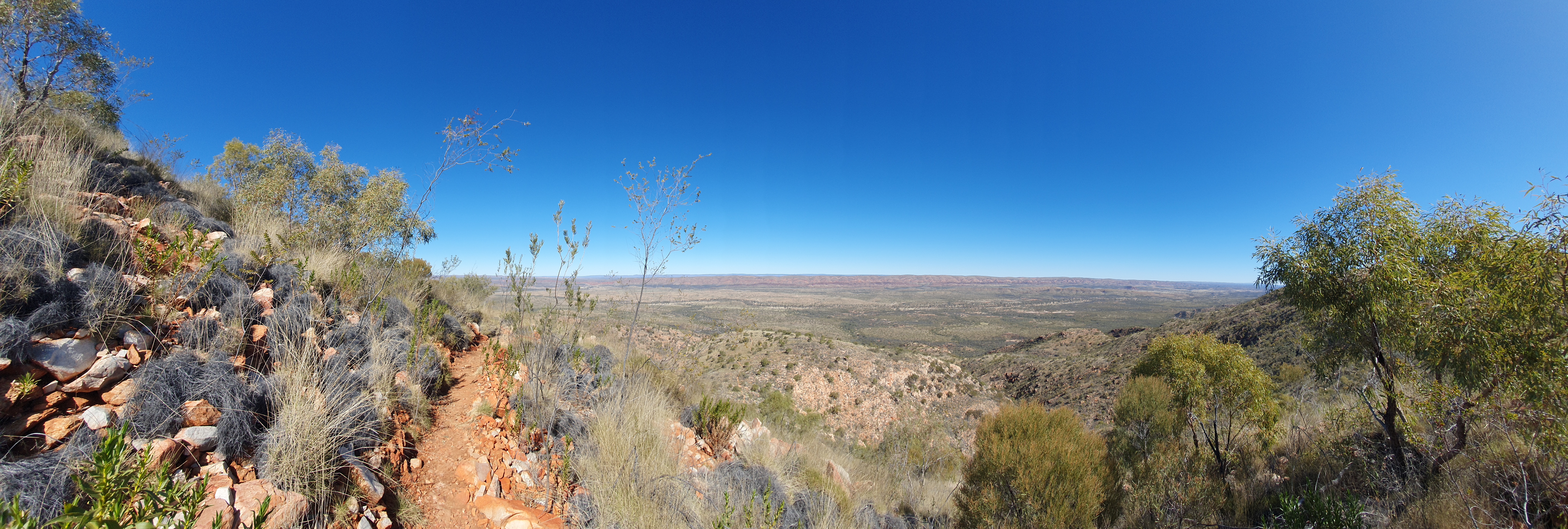
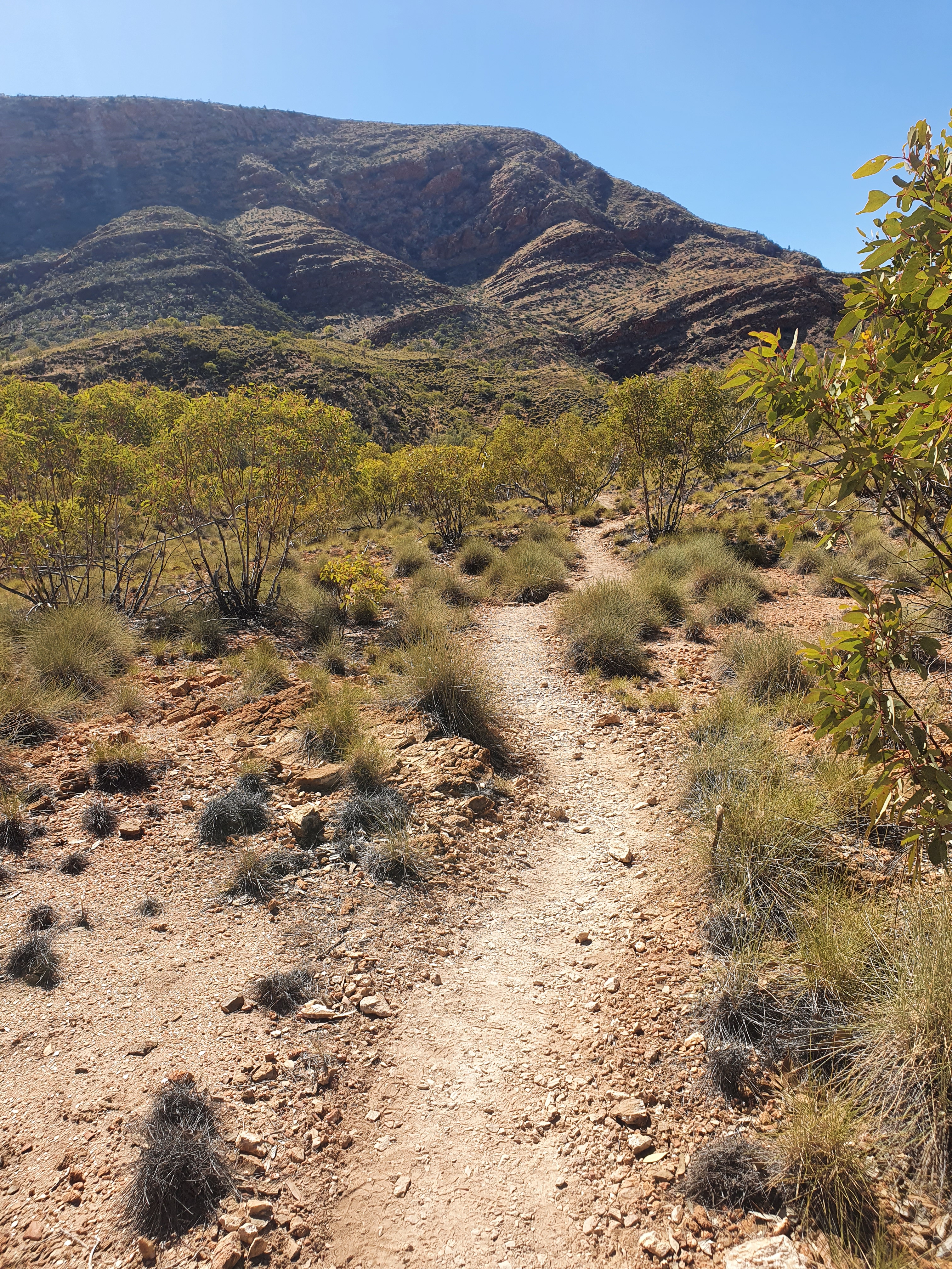
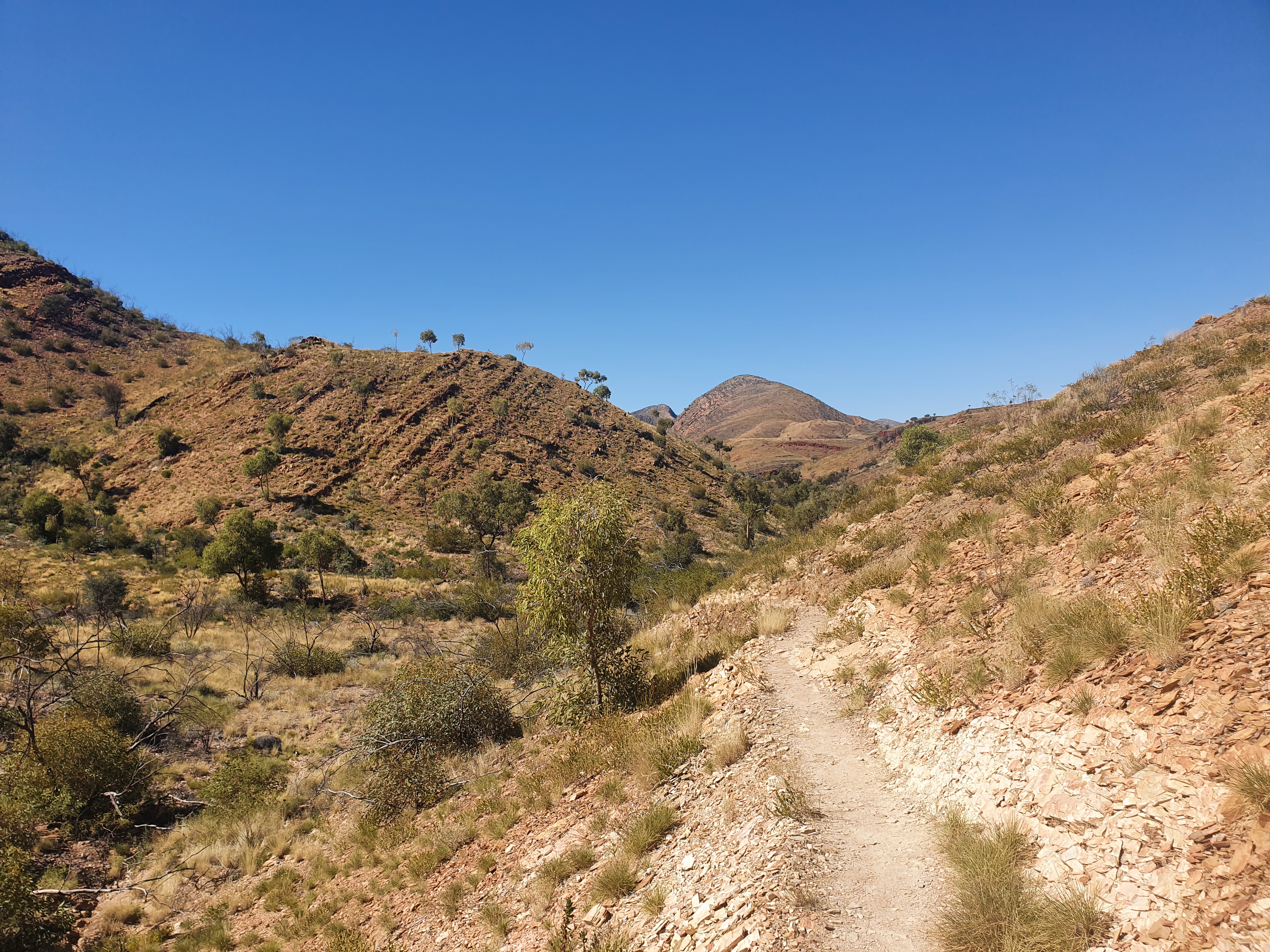
Hilltop was our first real climb (with the exception of the Sonder saddle), reached by a series of very lovely long switchbacks. I remembered the joy of switchbacks from my time hiking the Appalachian Trail, and how sad I was when they replaced switchbacks with straight stepped ascents. The same was true of the Larapinta. A switchback keeps the gradient much more manageable which means less scrambling and a kinder experience all round for the knees and ankles (and of course your back).


Though also on the Finke River, we didn’t take the 3.5km side trip to Glen Helen. We did hear from other walkers later in the hike that they have a lovely salad bar there. I think if I were heading the other way and was nearing the end of my hike, I’d be willing to take the side trip for the sake of a plate of fresh salad. As it was, I had my sights set on the next day’s destination: Ormiston Gorge, where rumour had it they had toasted veggie focaccias…
We bypassed the waterhole photographed above and two subsequent water crossings, arriving at our Finke River campsite with dry feet as the sun was going down.


Day Four – Section 10 – Finke River to Ormiston Gorge
We rose and departed a little earlier again this day (but were still the last to leave camp). We only had 8.9km to hike, but the aim was to get to Ormiston Gorge before the kiosk closed so we could sample one of their famed sandwiches. Ormiston was the site of our first resupply and the place where we planned to take our first rest day. We explored the Finke River trail shelter before we departed and found evidence of the mice that Mel had warned us about in the chewed remnant food packaging that hikers had left in the trail shelter cupboards.


We rolled into camp in good time, but sites were few and far between at the Ormiston Trail shelter due to an Army group sharing the space with us other hikers. There were four such groups on the trail at the same time as us, each comprising eight people, with each group setting out on a subsequent day so as not to overload the campgrounds with too many members from their overall contingent at once. We met two of these groups over the time we were on trail. There was no riverbed camping permitted in the Ormiston Gorge or Pound area, so we found a couple of spots just outside the shelter for our first night, relocating to sightly more private sites the following day. The sandwich was everything we hoped it would be and more.
Coming up next – Days 5-7: Section 9 – Ormiston Gorge to Serpentine Chalet Dam
