Currently Reading: Cassandra Pybus – Truganini | Celeste Ng – Little Fires Everywhere | Richard Flanagan– Death of a River Guide| Kyle Perry – The Bluffs
Still off the reading wagon – the TBR pile is currently a little neglected but it is not forgotten…
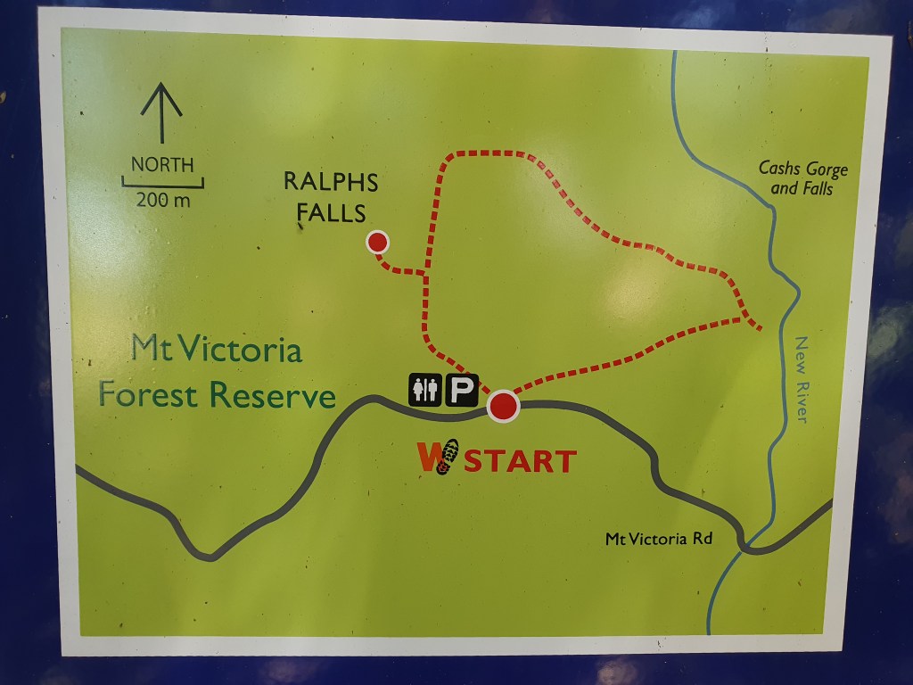
Ralphs Falls is listed as one of Tassie’s 60 Great Short Walks– and it is not hard to see why. This is an easy track through an incredibly diverse range of forest ecosystems – from lush rainforest to open sclerophyll forest to open buttongrass plains via waterfalls and rocky gorges, all in under an hour.
All of the Short Walks have one of these signs at the start, which includes a map and brief description.I always take a photo of any maps provided at the start of a walk for ease of reference in the event that I find myself at a tricky intersection or turning point and need to clarify my location.
The drive in is a little hairy, but it’s a well-graded road that receives a low volume of traffic, so on a scale of Midlands Hwy (1) to Jacobs Ladder (10), I’d put it at about a 7.
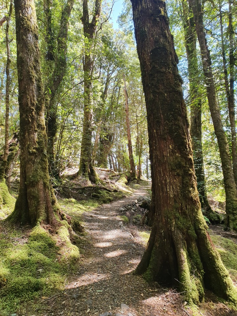
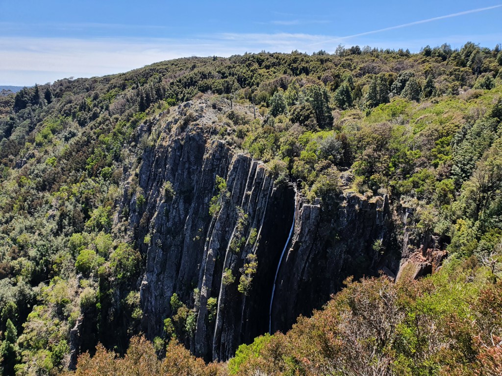
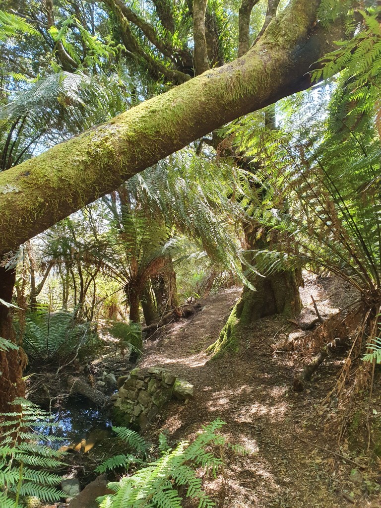
Loo with a view – you’ll need to bring your own TP and hand sanitiser if you’re planning on using this one.New life from old …A well maintained track and clearly signposted.I could not get the grin off my face – how beautiful is this?!!Treehuggers …Ralphs Falls – not much water coming over the edge of the falls but look at those curves!Looking back down the valley from the platform overlooking the falls.Even the retaining walls make use of locally sourced materials, blending in with the surrounding landscape.Part of the waterway feeding the falls – I’d love to see this after a heavy rain.Climbing again after crossing the stream.The wallabies must love this place as much as we humans do.The forest starts to change once you cross the stream, with more light filtering through to the grassy edges of the track.A little more evidence of the trackwork through this section.It’s always so lovely to spend time in the forest on a clear sunny day.The lookout above Cashs Gorge (these absent apostrophes in place names make me a little twitchy … )Cashs Gorge ( … but I try to present them as they appear on the map)There is duckboarding through the button grass almost all the way back to the car park from Cashs Gorge.The trail has been built atop the old bridle path.The varied terrain is one of the absolute highlights of this walk.Other peaks in the distance yet to climb …I think this duckboard nearly rivals the 2km stretch of boardwalk on the Three Capes track for length.
The day I drove to Ralph Falls, I was feeling like a bit of an adventure, so I kept driving the back forestry roads until I emerged at St Helens. I was actually looking for St Columba Falls, but the connector road to Pyengana from Ralphs Falls (along which the St Columba Falls offshoot is located) was closed, and not one to be deterred, I chose the only other available road at that intersection, which took me beyond the scope of the map of Tasmania that I was using as my guide, and inadvertently, to Mt Albert Road, which though itself a dirt road, felt like a 4 lane hwy compared with the grade of roads I’d taken to get there. My phone didn’t have reception and my map lacked sufficient detail, so for a couple of hours I was just feeling my way. In an age where it’s begun to feel as though there is no such thing as ‘off the map’ anymore, it was wonderful to get to embrace the unknown with that spirit of adventure. And it felt pretty good to know that my sense of direction could lead me to such a beautiful place, even unintentionally.
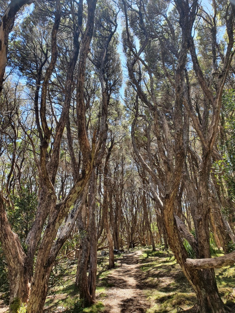
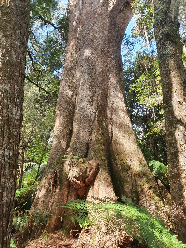
I grabbed a fish wrap from Skippers (these things are the best!) then headed back to Bridport via the Blue Tier, stopping in at The Big Tree Giant Walk for another wander along the way.
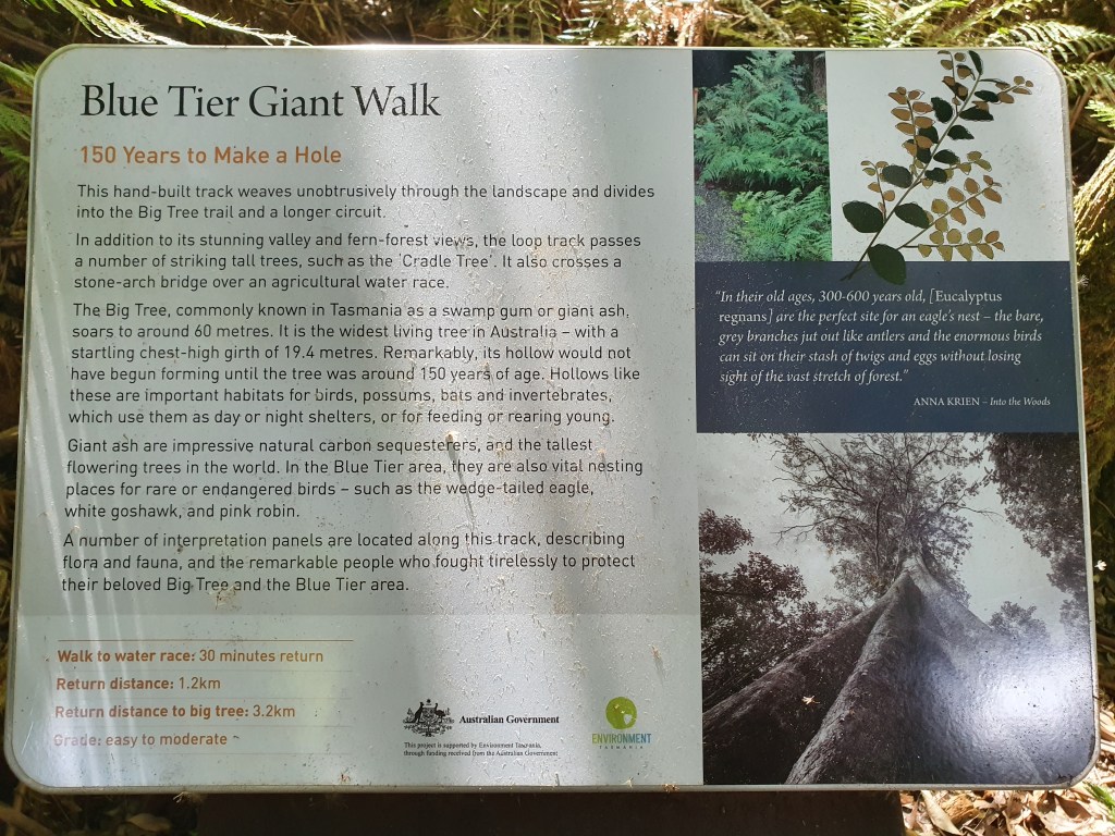
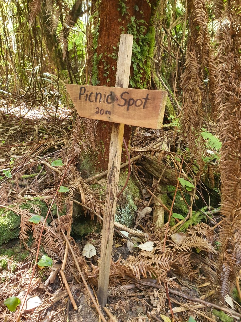
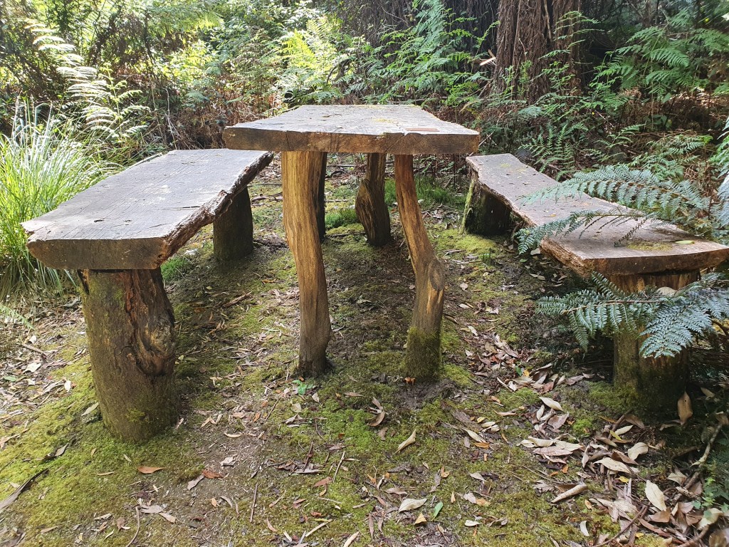
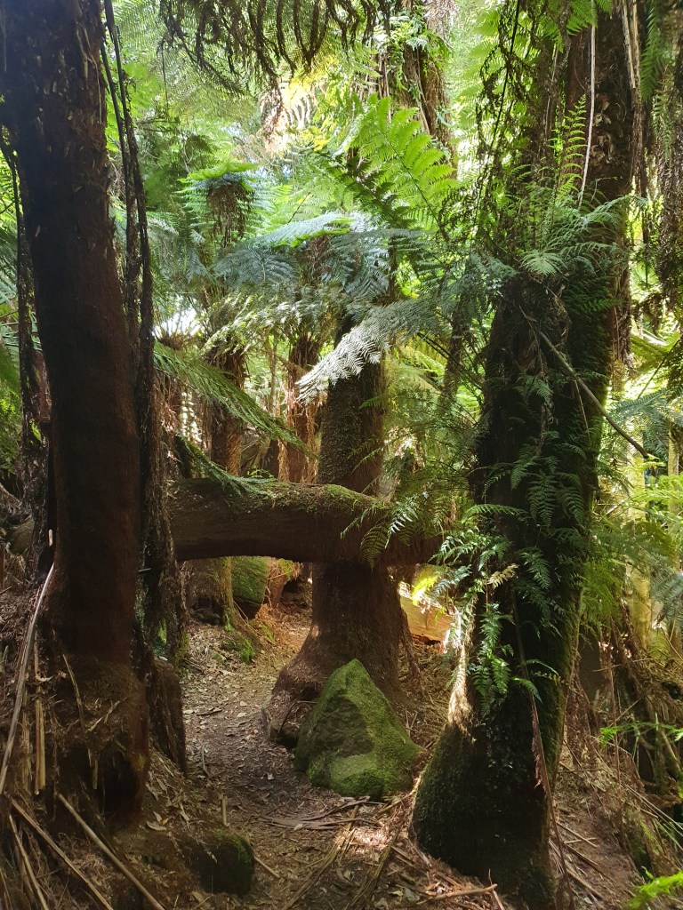
This is not the Big Tree, but its size did grab my attention – this one is located just beyond the car-park opposite the track entrance.Worth a read.This simple little sign leads to a fairy glen.I wished I’d saved my fish wrap to eat here. How sweet is this discovery?!Other big trees line the walk (still not the Big Tree) …… but beautiful specimens in and of themselves.Although there were still a good three hours of daylight left in the day, it got progressively darker as I descended through the dense forest.Mossy and ferny and cool and damp on a hot day.According to the signage at the start of the walk, the Big Tree has a girth of over 19m and is the widest living tree in Australia.The Big Tree has become something of a symbol in the fight against clearfell logging in the Blue Tier region. With so much of the surrounding land having already been cleared, this remains one of the last remaining pockets of Forest Reserve. You can read more about the dispute here.I just couldn’t do it justice with my phone camera …What a privilege to be in the company of something so ancient.The hollow you see here would only have started to form when the tree reached 150 years of age.Friends of The Blue Tier.I’m so glad I took the three km detour off the main road to check this out.
Tassie’s northeast corner has so much to offer. From beaches to waterfalls, from Blue Tiers to blue lakes, from rivers and railtrails to treetops and dunes, and all the activities these locations provide.
Next up I’ll be writing about a couple of the rides Mum and I have done lately in the Derby area.