Currently Reading: Cassandra Pybus – Truganini | Celeste Ng –Little Fires Everywhere | Richard Flanagan– Death of a River Guide| Kyle Perry –The Bluffs
Not much reading going on, I have to admit… it’s summer and the sun is shining and the outside is calling…
Over the course of the last few months, I’ve paid several visits to the east coast for the sake of gathering information for a book I am researching on the Abalone industry here in Tasmania. The following photos are from a three night camping trip in the Binalong Bay area where I camped in a different spot each night, conducted a series of interviews and explored as much as I could of the north-east corner of the state. As is always the case, I will have to return again and again to truly do these spaces justice, but here is a taste of some of the things I discovered.
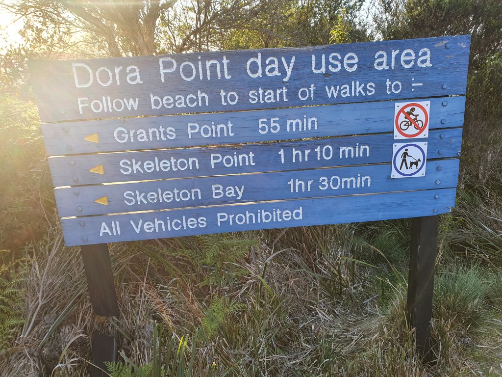
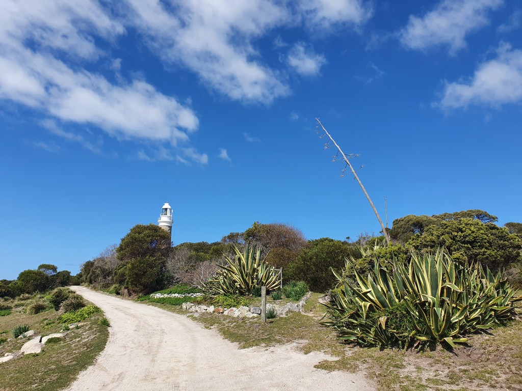
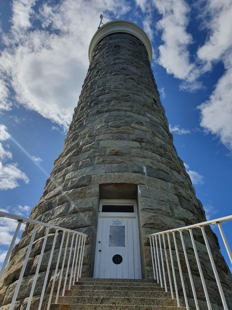
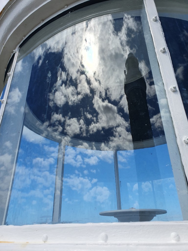
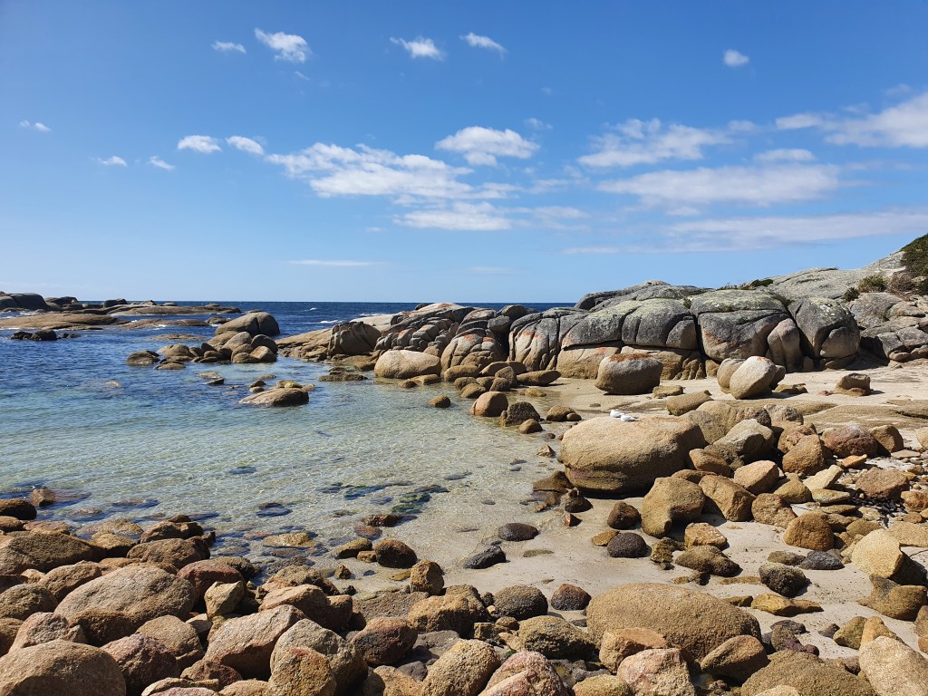
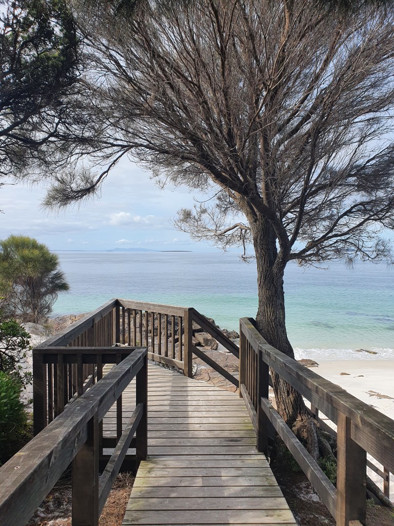
Sunrise at Dora PointMorning Walk from Dora Point to Skeleton PointSun and sand – a sign of things to comeLove that morning lightThis is an easy walk of about an hour and a half return with fantastic little beaches and rock formations along the way – perfect for a quick dipLooking back towards the beach at Dora PointWalking at this hour just makes you feel good about lifeI returned here later for an afternoon swimGrants Point rocks – lots of little rock pools to explore along this entire stretch of coastGrants PointStart of the Humbug Point walking track – a hike to complete at a later timeDora Point campsite – you get lots of space to yourself in these secluded sites, just a short drive from all that the Bay of Fires area has to offerBinalong BayI have had several visits to Binalong in recent times, as I’ve started conducting interviews for a book project I’m working onIt’s beautiful in all kinds of weatherMoody skies don’t detract from the wonderful swimming possibilitiesIt’s a great spot for a picnic if you’re day tripping, but even better for a weekend (or even longer if you have the time). You can free camp for up to a month at any of the beach-side campsites between Binalong Bay and the Gardens (and at Dora Point)Sheltered coves all along the coast mean you can almost always have a private beach to yourself – what a place! After Dora Point I spent a night at Jeanneret BeachJeanneret Beach rocksLooking south along Jeanneret BeachThis rocky headland separates Jeanneret and Swimcart Beaches – one of my missions this year is to walk this entire stretch of coast (in sections) – I’ll just chip away at a little more with each visitI spent a third night at Seaton Cove, where I was kept up most of the night by a doof-doof party in the camp next to mine, but it’s all part of the fun right?! I rose early and caught this early light on the trees next to my van. No filter here folks – just that early morning peach glow.Sunrise over Sloop Reef rocksI drove up to Eddystone Point and Deep Creek to see what I could seeThe lighthouse at Eddystone is a lovely specimenIn absolutely mint condition tooThe two lighthouses side by sideLighthouse stats for the pharologists among usThey really draw you in, don’t they? (When at sea, of course, the opposite is true…)Beautiful detailSneaky glimpse insideHow clean is that glass?!One last angleEddystone Point
I printed and framed this image to see how would look in a mount – lovely colours and contrastsThis structure is just next to the Eddystone Point boat rampFound a bone graveyard – I’m normally a collector of animal bones but something told me to leave these pieces beLooking east from the gulchLarc beach, located north of Eddystone Lighthouse can be accessed via a short track around the headland The sands here are about as pristine as you can get – the birds here are as fascinated by you as you are by themI can’t believe I didn’t swim here – it was super windy, but that seems a poor excuse – I’ll return on a calmer dayThe beach at Deep CreekPicnic Rocks, located just south of Deep Creek I spent quite a bit of time on these rocks just marvelling at the colour and clarity of the waterA little further north, on the road in to Musselroe Bay, is the short climb to Mt William, for which the national park is namedIt’s an easy ascent – the sign says 45, but it took me a little over 20 minutes each wayIt’s a pretty walkAnd you don’t even know you’re climbing until about the last 5-10 minutesAlthough hardly a mountain by normal standards, it is the highest point for miles around Mt William commands a good view in all directions from the summitCool looking lichen / moss / fungus ???Organic veggie stall in the otherwise very non-commercial Musselroe Bay – fresh veg, what a treat!Little Musselroe BayStriking rocks line the shore of Little Musselroe Bay
I’m currently spending some time at my cousin’s beach house in Bridport, and have been doing my best to fill in some of the gaps in my northeast explorations during my time here. Next week I’ll do a write up of some of the areas not yet touched upon in this post, including the beaches of the north coast, the waterfalls of the Blue Tier and surrounds and the internationally renowned bike-riding mecca of Derby.
Books Completed: Favel Parrett: When the Night Comes


Glorious scenery, thanks for sharing it!
LikeLike
Thank you! And you are very welcome! 😀 It’s such a beautiful part of the world. 🌏💙💚
LikeLike
Glad to see the van is still going well!
LikeLike
Yep, she’s still going strong! 🚐👍
LikeLike